
Map of the gorge
Location
Lidečko
Navigation in Mapy.cz
Navigation in Mapy Google
Possible place of refreshment: The Pulčín Restaurant (1km)
Time: 4:00h
Ascent: 2:30h
Descent: 1:30h
Difficulty
Elevation difference: 330m
Trail description
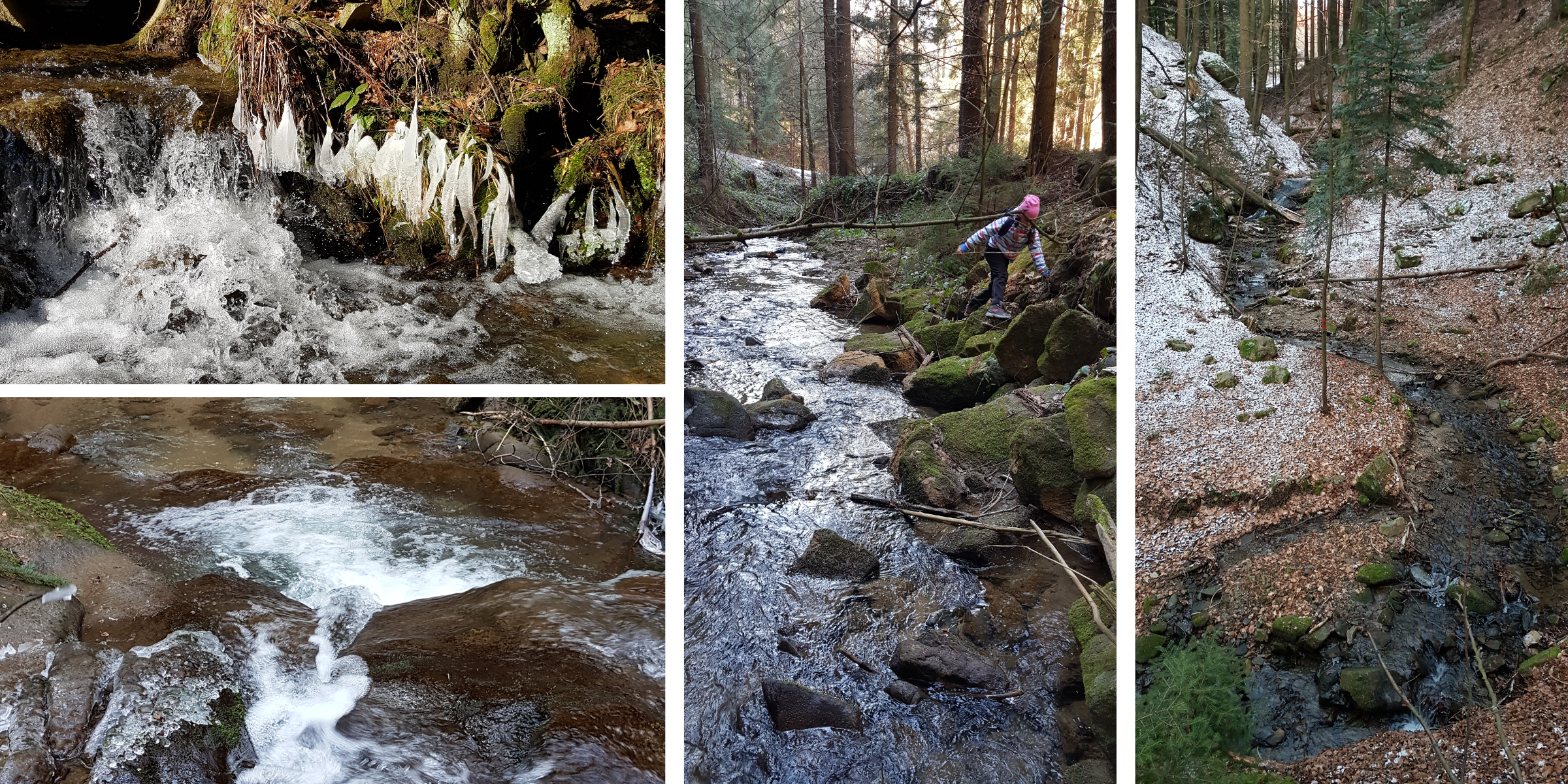
This trail begins in the village of Lidečko in front of a rail bridge at the turn-off to the village of Pulčín. The gorge of the Pulčínský brook, a long and adventurous one, starts right behind the bridge. The beginning of the trail might be a little difficult because of logging but it is still worth it to walk right by the brook. After about a kilometre the trail leads only in the woods. This area is rocky, so you will find many interesting stones, stone thresholds and isolated boulders in the gorge.
Until the confluence of 3 brooks the trail is the same as gorge #5. At this point, turn into the gorge of the stream that flows from the right. You will pass through a beautiful gorge that will lead you directly below the Pulčínské Rocks. Then follow the blue hiking trail taking you to the rocks’ peaks with wonderful view of the surroundings.
The descending route first follows the red hiking trail down the rocks and then the blue hiking trail back down into the valley and to the parking lot.
Recommendation
In the part from the confluence of the 3 brooks up to the rocks, the stream forms the boundary of a Nature Reserve, so when ascending hike on the right side of the gorge. When returning along the blue hiking trail we recommend tasting delicious water from Plevák’s spring and Formanka spring.