
Map of the gorge
Location
Nový Hrozenkov, Brodská
Navigation in Mapy.cz
Navigation in Mapy Google
Time: 5:45h
Ascent: 3:00h
Descent: 2:45h
Difficulty
Elevation difference: 420m
Discovered for rokling.cz by Průzkumníklára.
Trail description
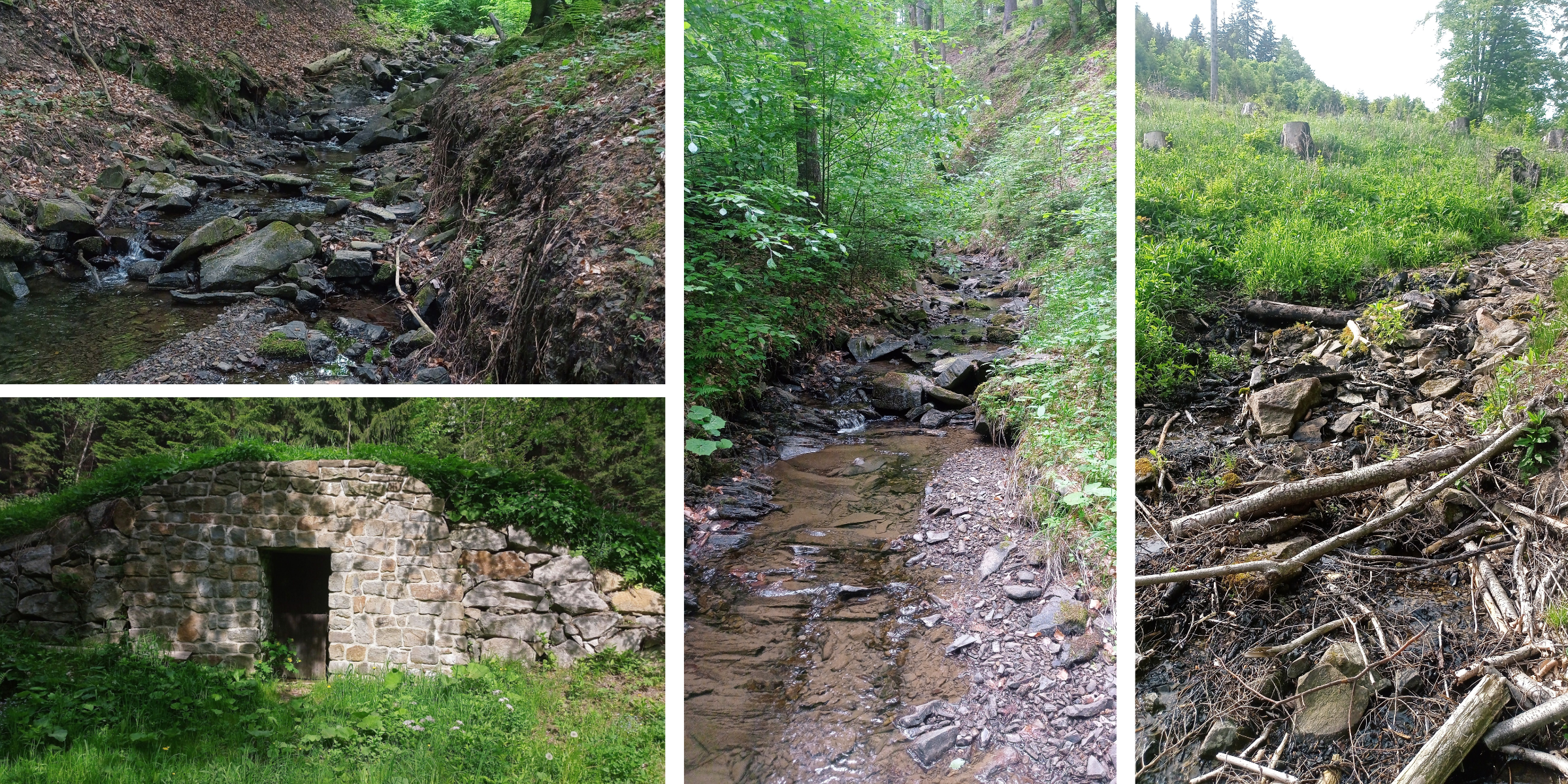
The route starts at the bus stop “Nový Hrozenkov – točna”, where you can park. Follow the asphalt road for about 1.7km to the “Rozcestí Brodská” crossroads. Turn right and after about 600m you can enter the streambed.
The gorge is quite gentle, but the higher you get, the steeper it becomes and the more obstacles it has prepared for you. The creek bed is made up of many pools, in which salamanders can be found after rain. The end of the gorge is very rocky – watch out for the sliding banks. The trail ends at the source of the Malá Brodská stream, from there take the blue hiking trail to Tanečnice Mountain, where you can find a memorial to the victims of fascism.
With its height of 912 m above sea level, Vsacká Tanečnice Mountain is the highest peak of the Vsetín Hills. According to a legend, a mother and her adult daughter who loved dancing lived in the nearby Brodská valley. One day the mother was sick and did not want to let her daughter go to a dancing party, but the girl ran away, danced all night in the Čarták pub under Soláň Mountain and in the morning, she waded through the snow back home. However, she did not make it back; her dead body was not found until spring by the loggers just below the peak of Tanečnice Mountain (Tanečnice means “a dancer” in Czech). They say pink forget-me-nots grow there in the summer because of her.
The descending route is the blue hiking trail, the end of the route is again at the bus stop.
Recommendation
The trail is lined with asphalt road, so it can be done with a stroller.
It is advisable to have good shoes, the gorge is very rocky towards the end. On hot days, you can refresh yourself with water from the natural well U Chladné vody (“Cold Water Spring”).