
Map of the gorge
Location
Vsetín, Jasenice
Navigation in Mapy.cz
Navigation in Mapy Google
Time: 1:20h
Ascent: 0:45h
Descent: 0:35h
Difficulty
Elevation difference: 150m
Discovered for rokling.cz by Průzkumníklára.
Trail description
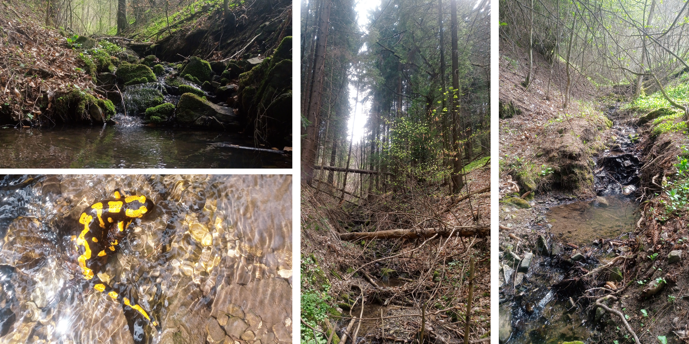
The route starts at the Jasenická tourist shelter, where you can park comfortably. From the shelter, follow the street Za Zastávkou for about 400 metres. Then the path ends, and the gorge begins – follow the stream.
The gorge is very simple with many nice obstacles, it ends at the source of the stream at about 550m above sea level, just below the yellow hiking trail leading to Cáb Mountain.
The descent route is a forest path that runs parallel to the gorge.
The gorge is home to many salamanders that stay near the watercourse. They are mainly active at night, during the day they move lazily along the watercourse or hide under rocks and leaves. Newts are venomous; in humans the venom only irritates the eyes and skin, but in smaller mammals it can be lethal. Newts are a highly endangered species in the Czech Republic, so be careful where you step and be considerate of them. 
Recommendation
If you set off for this gorge on a dry day, you won’t probably encounter any salamanders; they prefer moist conditions.