
Map of the gorge
Location
Velké Karlovice
Navigation in Mapy.cz
Navigation in Mapy Google
Possible place of refreshment:
The Súkenická Hotel (150m)
The Horal Hotel (300m)
Time: 2:45h
Ascent: 1:45h
Descent: 1:00h
Difficulty
Elevation difference: 290m
Trail description
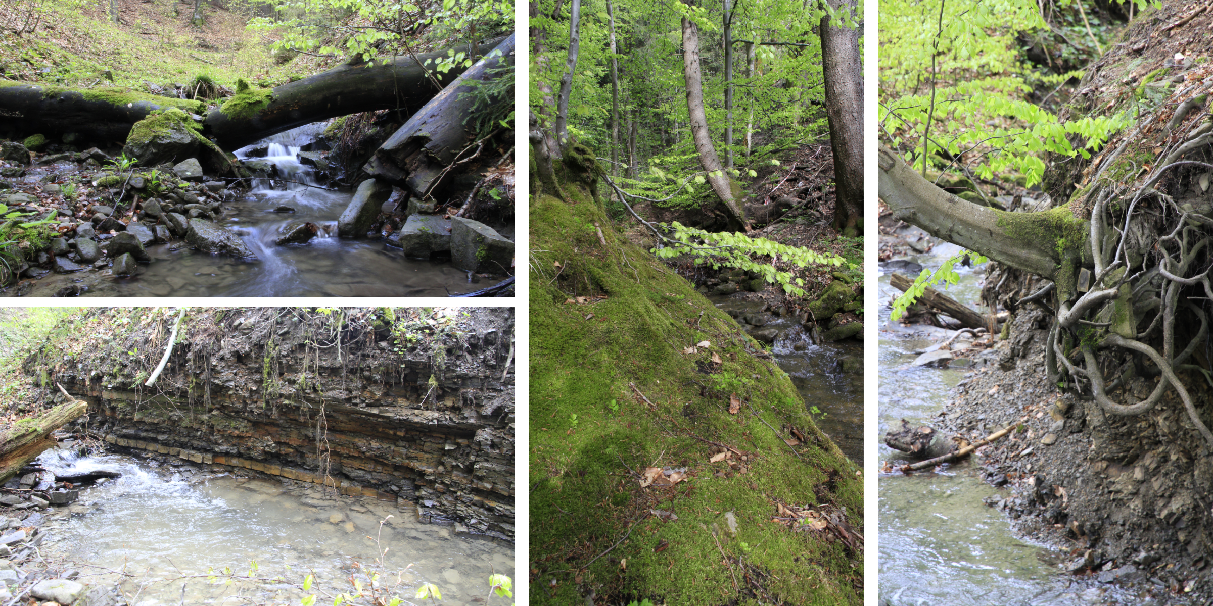
The route of the gorge leading to the source of the most important watercourse in the region starts at the Pod Javorem Hotel. After 300 m along local roads, you can start to get to know the Bečva as a small stream that gradually cuts into the terrain. In the first half, the route offers a nice gorge, a few simple obstacles and one geologically interesting place on the left bank with a sample of typical flysch layers, starting with larger brick-like stones and continuing upwards with smaller fractions. In the same place on the right bank you will again find another stone curiosity from the local geology. The upper part, even though it is the source of such an important river, has been much damaged by the establishment of a forest road right in the course of the Bečva, which, although it makes it easier to pass through the gorge, no longer allows to experience the gorge in its full glory. The spring itself joins from the left (turn right when climbing), it is not abundant, it even gets dry in part of the summer.
From the spring it is only a few steps to the main ridge of the Vsetín Hills, where you take the red hiking trail to the left. I recommend visiting the Čarták lookout tower, then return 150m and descend back to the starting point via the forest ridge.
Recommendation
This gorge is good for beginners and also doable with smaller kids.