
Map of the gorge
Location
Time: 4:45h
Ascent: 3:45h
Descent: 1:00h
Difficulty
Elevation difference: 300m
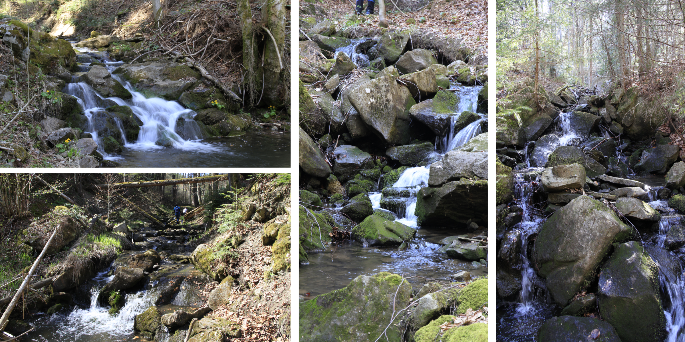
Trail description
The attractive climb to Tanečnice mountain (which means “a female dancer” in Czech) starts behind the last house in the Kobylská valley. You can park on the left in front of the no entry sign. It is better to walk along the road at first, because the banks of Kobylská are paved, but after 200m you can follow the stream bed. The trail is one of the rockiest. A gentler climb turns into beautiful cascades and small waterfalls until a confluence at about 2/3 of the route (marked on the map), where it is worth exploring 150m of an attractive tributary, and after returning back to Kobylská stream ascend up to below Tanečnice. The last third of the ascent is no longer rocky, the stream is gentle at first until it plunges into the gorge again with some challenging obstacles created by fallen trees.
The descending route follows a forest asphalt road just below the ridge, after returning from the spring turn right on the blue hiking trail from which you turn left after 200m onto a descending path and walk comfortably back to the starting point.
Recommendation
Tip for hikers with younger children: you can only go 2/3 of the way up the gorge and turn right at the junction with the descent road back to the starting point. The route will then be red in difficulty (=less demanding), shortened by more than an hour, and avoiding unpleasant obstacles in the upper passage, but still you will experience the most beautiful places of Kobylská stream.