
Map of the gorge
Location
Valašská Bystřice
Navigace přes Mapy.cz
Navigace přes Mapy Google
Possible place of refreshment: Santov Restaurant
Time: 4:00h
Ascent: 2:30h
Descent: 1:30h
Difficulty
Elevation difference: 360m
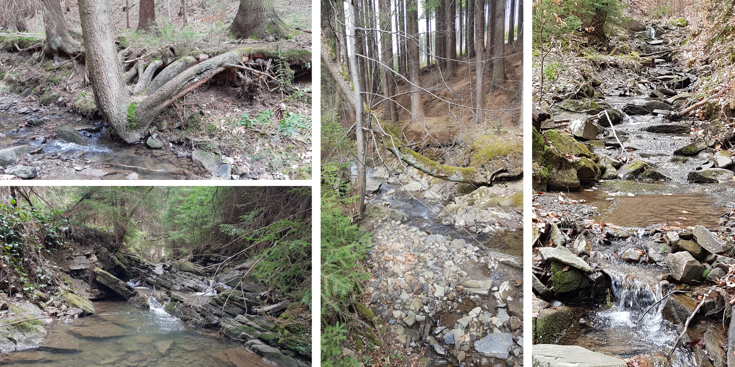
Trail description
The car park is in Valašská Bystřice village directly under the Břucko pond. The first part you will walk along a road, but after 200m beautiful places begin. The whole trail is very rocky, several times the water drops down on rock steps and cascades. It will be a challenge for everyone to cross these obstacles without wet shoes. This trail is moderate for the first two-thirds and only climbs more steeply at the end.
On the way back you will reach a forest asphalt road on the left just below the ridge. After about 300m you will come across a red ridge hiking trail, which you need to follow to the right until you reach the Pod Ptáčnicí saddle, from the saddle follow the yellow hiking trail again to the right towards Santov, and from Santov follow the green hiking trail back to the starting point.
Recommendation
Around the whole stream there is a good quality asphalt road suitable for strollers, so if you have bigger children in the gorge and small ones in the stroller, you can be together as a family. Only at the top does the path separate from the gorge with a long serpentine, but at the top it meets up with the gorge again at the finish point. With a stroller, you can use the asphalt road again for your way back.
At Santov, don’t miss the nice pub on the left of the path first, and then if you feel like having a dessert go 100 m further on the green hiking trail to taste and buy homemade milk caramel.